These functions can be used when working with and analysing geospatial data.
Function | Description |
|---|---|
geo::area() | Calculates the area of a geometry |
geo::bearing() | Calculates the bearing between two geolocation points |
geo::centroid() | Calculates the centroid of a geometry |
geo::distance() | Calculates the distance between two geolocation points |
geo::hash::decode() | Decodes a geohash into a geometry point |
geo::hash::encode() | Encodes a geometry point into a geohash |
geo::is_valid() | Determines if a geometry type is a geography type |
Point and geometry
A
pointis composed of two floats that represent the longitude (east/west) and latitude (north/south) of a location.A
geometryis a type of object defined in the GeoJSON spec, of which Polygon is the most common. They can be passed in to the geo functions as objects that contain a "type" (such as "Polygon") and "coordinates" (an array of points).
geo::area
The geo::area function calculates the area of a geometry in square metres.
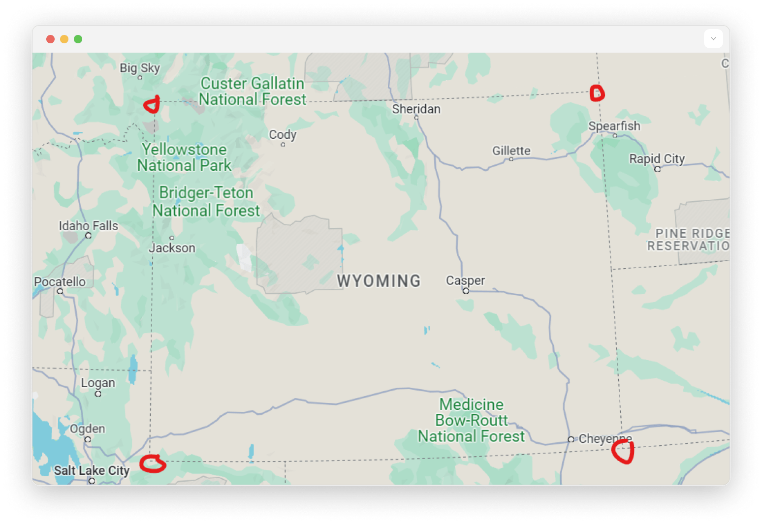
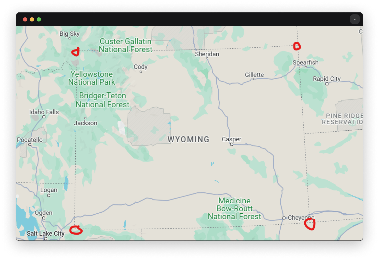
geo::area(geometry) -> numberThe following example shows this function, and its output for four approximate points found on a map for the US state of Wyoming which has an area of 253,340 km2 and a mostly rectangular shape. Note: the doubled square brackets are because the function takes an array of an array to allow for more complex types such as MultiPolygon.
geo::area({
  type: "Polygon",
  coordinates: [[
    [-111.0690, 45.0032],
    [-104.0838, 44.9893],
    [-104.0910, 40.9974],
    [-111.0672, 40.9862]
  ]]
});253317731850.3478fIf the argument is not a geometry type, then an error will be returned.
geo::area(12345);'Incorrect arguments for function geo::area(). Argument 1 was the wrong type. Expected `geometry` but found `12345`' geo::bearing
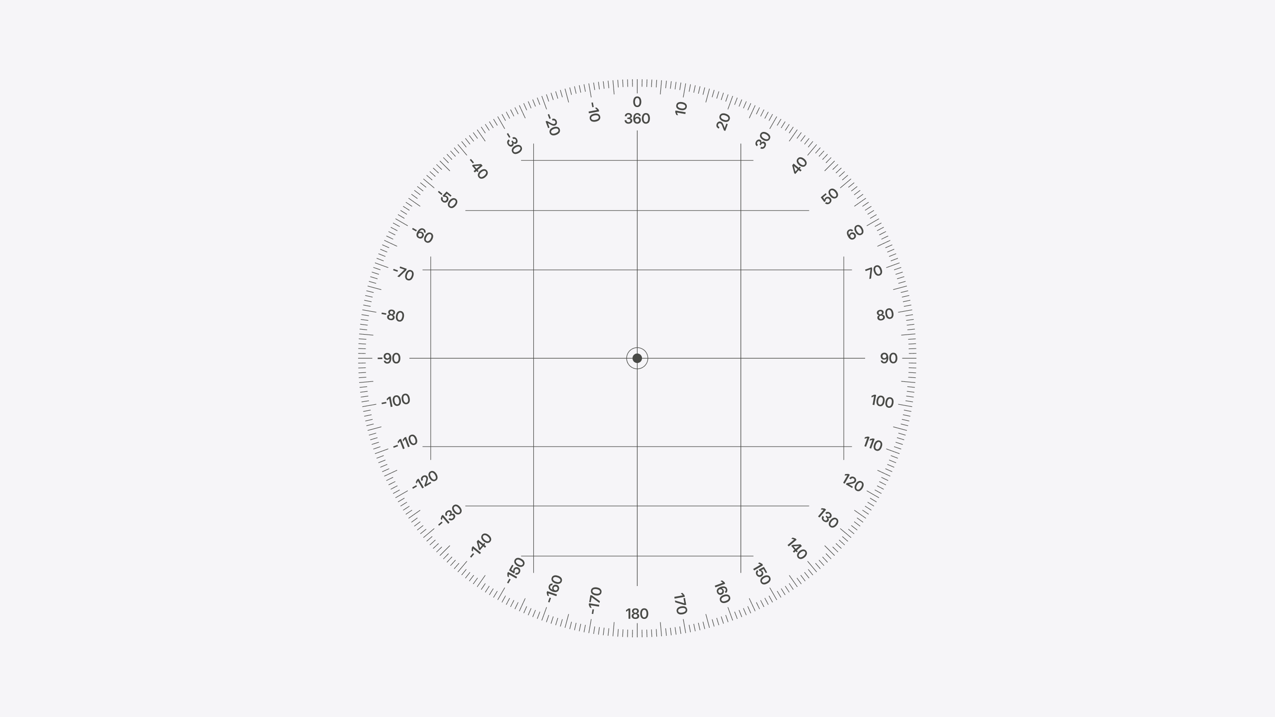
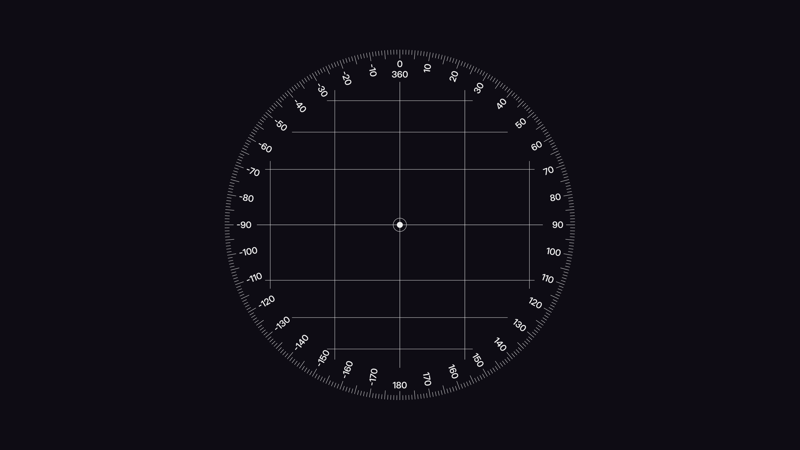
The geo::bearing function calculates the bearing between two geolocation points. Bearing begins at 0 degrees to indicate north, increasing clockwise into positive values and decreasing counterclockwise into negative values that converge at 180 degrees.
geo::bearing($from: point, $to: point) -> numberThe following example shows this function, and its output:
-- LET used here for readability
LET $paris = (2.358058597411099, 48.861109346459536);
LET $le_puy_en_velay = (3.883428431947686, 45.04383588468415);
RETURN geo::bearing($paris, $le_puy_en_velay);
RETURN geo::bearing($le_puy_en_velay, $paris);-- Slightly east of directly south
164.18154786094604f
-- Slightly west of directly north
-14.70308114652183f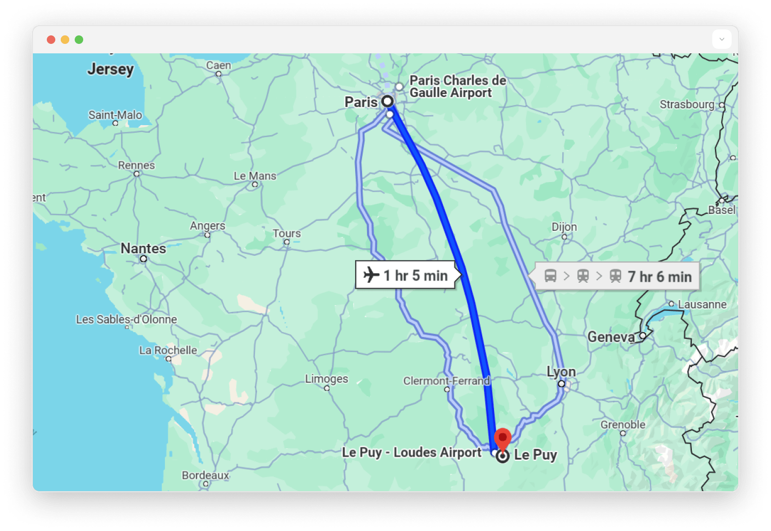
geo::centroid
The geo::centroid function calculates the centroid between multiple geolocation points.
geo::centroid(geometry) -> numberThe following example shows this function, and its output. Note: the doubled square brackets are because the function takes an array of an array to allow for more complex types such as MultiPolygon.
geo::centroid({
  type: "Polygon",
  coordinates: [[
    [-0.03921743611083, 51.88106875736589], -- London
    [30.48112752349519, 50.68377089794912], -- Kyiv
    [23.66174524001544, 42.94500782833793], -- Sofia
    [ 1.92481534361859, 41.69698118125476] -- Barcelona
  ]]
});
The return value is a mountainous region somewhere in Austria:
(13.483896437936192, 47.07117241195589)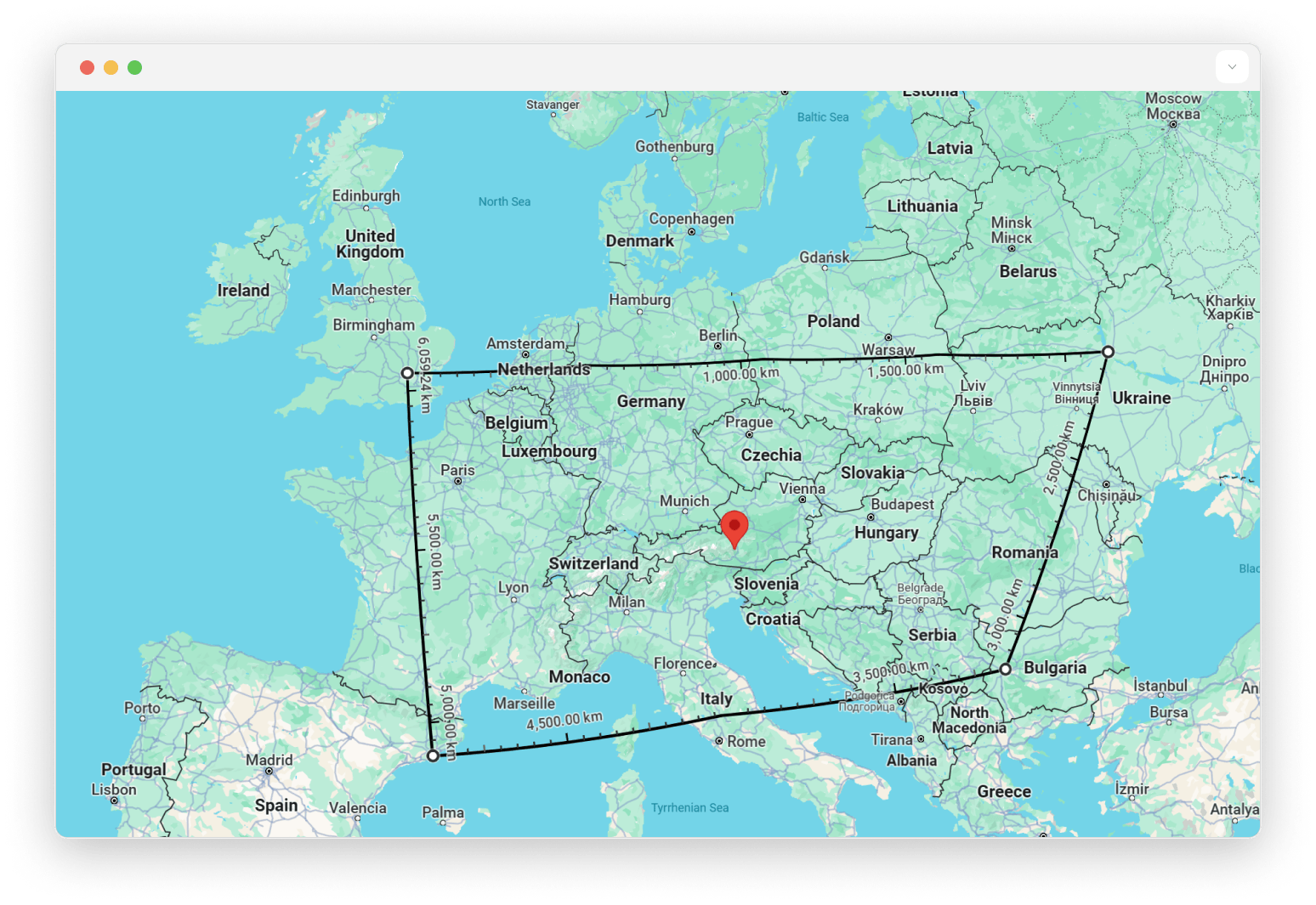
geo::distance
The geo::distance function calculates the haversine distance, in metres, between two geolocation points.
geo::distance($from: point, $to: point) -> numberThe following example shows this function, and its output:
let $london = (-0.04592553673505285, 51.555282574465764);
let $harare = (30.463880214538577, -17.865161568822085);
RETURN geo::distance($london, $harare);8268604.251890703f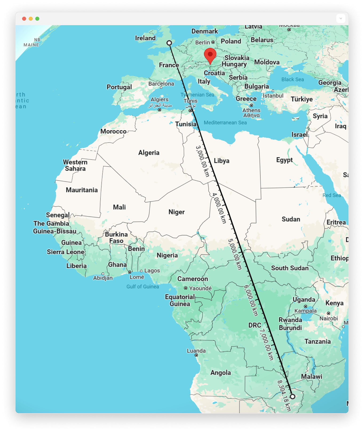
When the points are stored in records, pass the field of each record, such as city:london.location. A SELECT returns an array of objects rather than a point, so passing its result fails:
CREATE city:london SET location = (-0.1278, 51.5074);
CREATE city:paris SET location = (2.3522, 48.8566);

geo::distance(city:london.location, city:paris.location);
//- 343556.53488088324f

geo::distance((SELECT location FROM city:london), (SELECT location FROM city:paris));
//- "Incorrect arguments for function geo::distance(). Argument 1 was the wrong type. Expected `geometry` but found `[{ location: (-0.1278, 51.5074) }]`"
To compute the distance from one point to every record in a table, use the field in the projection, as in SELECT id, geo::distance(location, city:london.location) AS distance FROM city.
geo::hash::decode
The geo::hash::decode function converts a geohash into a geolocation point.
geo::hash::decode(point) -> stringThe following example shows this function, and its output:
geo::hash::decode("mpuxk4s24f51");(51.50986494496465, -0.11809204705059528) geo::hash::encode
The geo::hash::encode function converts a geolocation point into a geohash.
geo::hash::encode(point) -> stringThe function accepts a second argument, which determines the accuracy and granularity of the geohash.
geo::hash::encode(point, $granularity: number) -> stringThe following example shows this function, and its output:
geo::hash::encode( (51.509865, -0.118092) );'mpuxk4s24f51'The following example shows this function with two arguments, and its output, when used in a select statement:
geo::hash::encode( (51.509865, -0.118092), 5 );'mpuxk' geo::is_valid
The geo::is_valid function determines if a geometry type is a geography type. Geography types are used to store geolocation data in a Geographic Coordinate System (GCS), whereas geometry types can store geolocation data in any coordinate system, including GCS, mathematical planes, board game layouts, etc...
A geography type adds the following constraint: each Point coordinate is in the range of -180° to 180° for longitude and -90° to 90° for latitude.
geo::is_valid(geometry) -> boolThe following examples show this function, and its output:
geo::is_valid( (51.509865, -0.118092) );

-- truegeo::is_valid( (-181.0, -0.118092) );
-- false